ABRAMS FALLS
Hiking through Great Smoky Mountains National Park is a magical experience as you are enveloped by the sights and sounds of nature. When planning your hiking adventure make sure to visit Abrams Falls. This moderate five-mile roundtrip hike is lined with beautiful geological structures, and at 2.5 miles you are met with the breathtaking Abrams Falls.
The name of both the creek and the trail are derived from a Cherokee Chief named Oskuah whose village was miles downstream from the waterfall. He later adopted the name Abram which was given to the waterfall and trail.
Hiking Abrams Falls
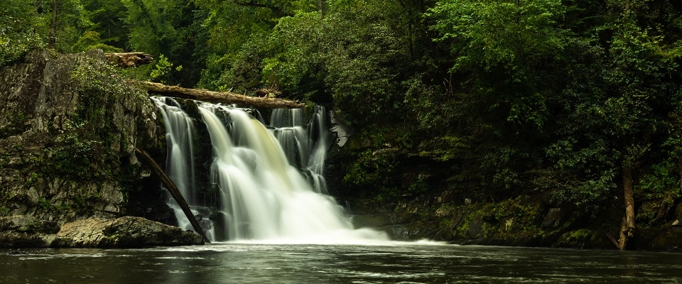
The Abrams Falls trail is considered to have one of the most voluminous waterfalls in Great Smoky Mountains National Park. Standing only 20 feet high the fall makes up for its vertical with the abundant rushing water falling into the pool below. It is extremely dangerous to swim in the water below the falls due to the unexpected strong currents. The tantalizing view of the pool and waterfall behind it may be hard to resist, but park officials urge hikers to show restraint for safety purposes.
Abrams Falls trail is not too long but the moderate difficulty boosts the trails popularity amongst hikers during peak season. The trail begins at a large wooden bridge that crosses over Abrams Creek. The creek itself follows next to the trail for most of the hike making it a soothing feature for hikers. During the first half of the trail there are a few spots that will require some maneuvering with ridges. There are also a few rock-hopping creek crossing opportunities as well.
The trail from Cades Cove will take hikers up to the waterfall and navigate them through a pine-oak forest throughout the ridge tops. Hemlock and rhododendron thickets can also be seen close to the creek edge. By the 2.5-mile mark the trail crosses over another waterway named Wilson Creek that will take hikers to the 20 foot plunge of Abrams Falls.
Before you plan your hike make sure you check the Smoky Mountain weather for the day. Below you will find a list of handy items to take on your day of hiking!


Directions to Abrams Falls Trail
- To start the hike at Abrams Falls, begin from the field at stop #10 on the Cades Cove Loop Road.
- To reach the Abrams Falls trailhead, drive five miles on the Cades Cove Loop.
- Once you’ve crossed Abrams Creek, turn right onto a gravel road which runs through a grassy field.
- Parking at the back of the field can be found where both signs and a wooden bridge mark the trailhead
Day Hiker’s Checklist
- Raingear – Carry a rain jacket or poncho at all times in the Smokies. Rain pants should be included in colder weather.
- Water – Carry two quarts per person on longer hikes.
- Extra Clothes – Cotton is not recommended in cold weather or at high elevations. Carry clothing that will keep you warm when wet such as wool or synthetic “fleece.”
- Map – A variety of park trail maps are available. Keep one in your pack at all times.
- Food – Carry high energy snacks and eat often.
- Flashlight – A good flashlight or headlamp is welcome if you are caught out on the trail after dark.
- Matches – Waterproof matches are best.
- Whistle – Bring a whistle to signal rescuers if lost. All children should carry one.