Best Spring Hikes in the Great Smoky Mountains
On April 19, 2024
There is no better way to get outdoors and enjoy nature and its beauty than on a spring hike in Great Smoky Mountains National Park. Spring is the perfect time of year to hike and explore as the spring wildflowers are starting to bloom and wildlife is beginning to emerge from the cold winter hibernation.
Great Smoky Mountains National Park is home to more than 800 miles of trails, so rest assured, you’ll find a hiking adventure to suit everyone’s taste and skill level. We’ve pulled together 5 of our most popular spring hikes in the Great Smoky Mountains as well as 5 spring hikes that are perfect for the whole family!
Note: Laurel Falls Trail is expected to close for construction beginning in November 2024 and lasting for 18 months. Please consider alternative hikes if you are visiting during this time. LEARN MORE–>
Most Popular Spring Hiking Trails in the Smoky Mountains
Abrams Falls Trail
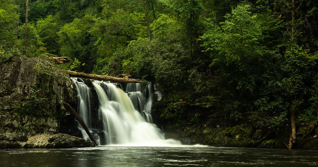
Abrams Falls is a must-see with its beautiful 20-foot-tall waterfall. It is 5.2 miles roundtrip and of moderate difficulty, primarily due to the slick rocks surrounding the waterfall. The Trailhead is located at the far western end of Cades Cove and can be reached along the Cades Cove Loop Road.
You will follow along Abrams Creek for most of the trail and may even need to jump some rocks along the way. Abrams Falls Trail is one of the most scenic hikes in the Smokies as hikers pass through pine-oak forest, rhododendron and hemlock forests. Once you reach the waterfall, you will be mesmerized by the sights and sounds of this beauty.
Alum Cave Trail
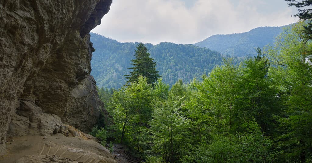
The hike to Alum Cave begins almost 9 miles south of the Sugarlands Visitor Center along Newfound Gap Road. From the Trailhead, Alum Cave is a 2.2-mile hike. There is a 1,200 feet elevation change and the trail can be steep along the way.
You will wander through the tunnel at Arch Rock and through a beautiful forest area. Alum Cave is actually a concave bluff that stands about 80-feet-tall. In the 1800s, epsom salt was mined from Alum Cave, then saltpeter was mined to make gunpowder during the Civil War. Hikers have the option to continue to the summit of Mount LeConte from this point.
Charles Bunion Trail
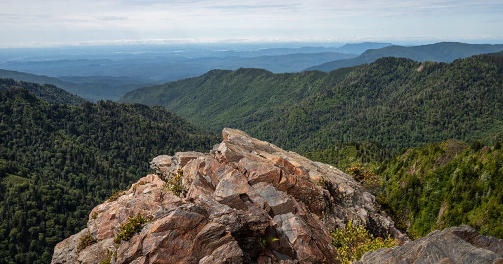
The Charles Bunion Trail is one for skilled hikers. This 8-mile roundtrip hike begins 13 miles south of the Sugarlands Visitor Center along Newfound Gap Road. Although the trail is challenging, it offers some of the best mountain and valley views, especially of Mt. LeConte and Myrtle Point.
Hikers will follow along the Appalachian Trail to reach the rock outcropping known as Charlies Bunion. Hikers will enjoy the scenic views of the North Carolina Smokies and prior to reaching the Sweat Heifer Creek Trail junction, the beautiful views of Mount LeConte and Myrtle Point. There is a 1,600-foot elevation change along the route and hikers will have to cross a few streams and negotiate some cliffs. The views at Charlies Bunion of Mt. Kephart to the north, the Jump Off to the west and Mount Guyot to the east are truly spectacular.
Chimney Tops Trail
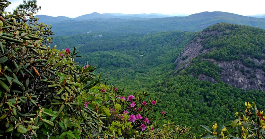
The Chimney Tops Trailhead is located between the lower tunnel and “the loop” on Newfound Gap Road. The short length of this trail and its amazing panoramic views have always made this a popular trail. The hike is steep however, as hikers will have to climb nearly 1,400 feet within 2 miles.
The trail is 4 miles roundtrip, and you will cross several streams in addition to climbing the side of the mountain. Look for rhododendron, mountain laurel and many other beautiful spring wildflowers as you make your way along the trail. Chimney Tops Trail officially ends about a quarter of a mile below the pinnacles, but the views of Mt. Le Conte and the pinnacles are second to none. Make sure to snap a few pics along the way too!
Rich Mountain Loop
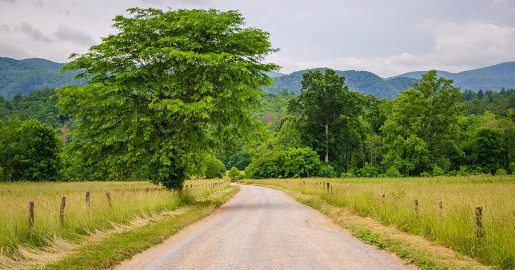
Rich Mountain Loop is in the Cades Cove area. It is about 8.5 miles long and a more difficult hike. However, it is a great way to explore the Cades Cove area. The trail starts off in a meadow where wildflowers cover the ground. The trail gets more difficult and strenuous once you reach the Oliver Cabin at about 1.4 miles.
If you choose to continue, you will be amazed by even more wildflowers and an old campsite at the Indian Grave Gap trail junction. The area offers a great view of Cades Cove. Near the end of the loop trail, you can see Crooked Arm Falls which is a 25-foot waterfall. Although long and strenuous, this hike is well worth the time!
Best Spring Hiking Trails for Kids in the Smoky Mountains
Gatlinburg Trail
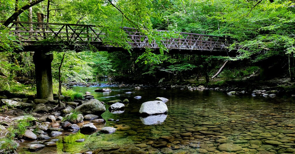
If you have younger children, the Gatlinburg Trail is a great option. The trail begins near the Sugarlands Visitors Center and is a 3.9-mile round trip. Along the way, hikers will pass remnants of an old homestead, including a chimney and other rock structures.
The trail then follows along the West Prong of the Little Pigeon River, making it easy for families to access the river and dip their toes in. And about half-mile from the trailhead in Gatlinburg, you’ll cross over the river on one of the longest footbridges in Great Smoky Mountains National Park.
Laurel Falls Trail
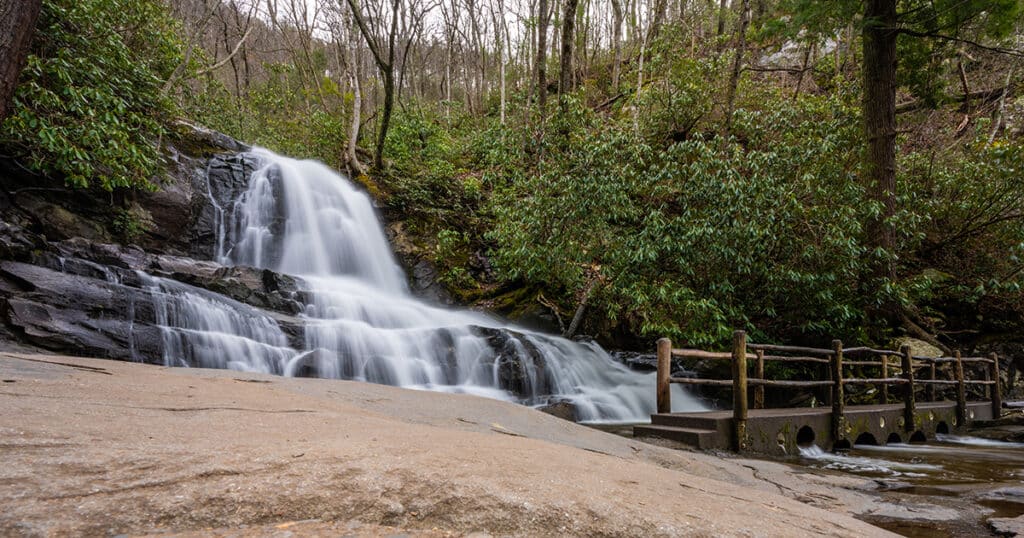
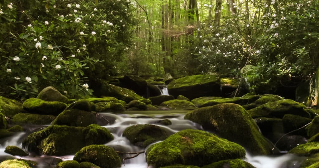
Laurel Falls are named for the mountain laurel that blooms along the trail in late spring. The Laurel Falls Trail is one of the most popular hikes in the park and it’s well suited for younger children. The trail is 2.6 miles round trip and considered easy to moderate in difficulty. The trail is paved the whole way, although rough and uneven in spots.
The moderately steep incline of this trail can also mean a bit of a workout, but the 80-foot-tall waterfall that awaits is truly a magnificent sight to behold. There is an upper and lower section of Laurel Falls with a walkway that crosses over the stream. You’ll have plenty of great opportunities for photos, so keep your camera ready!
Porters Creek Trail
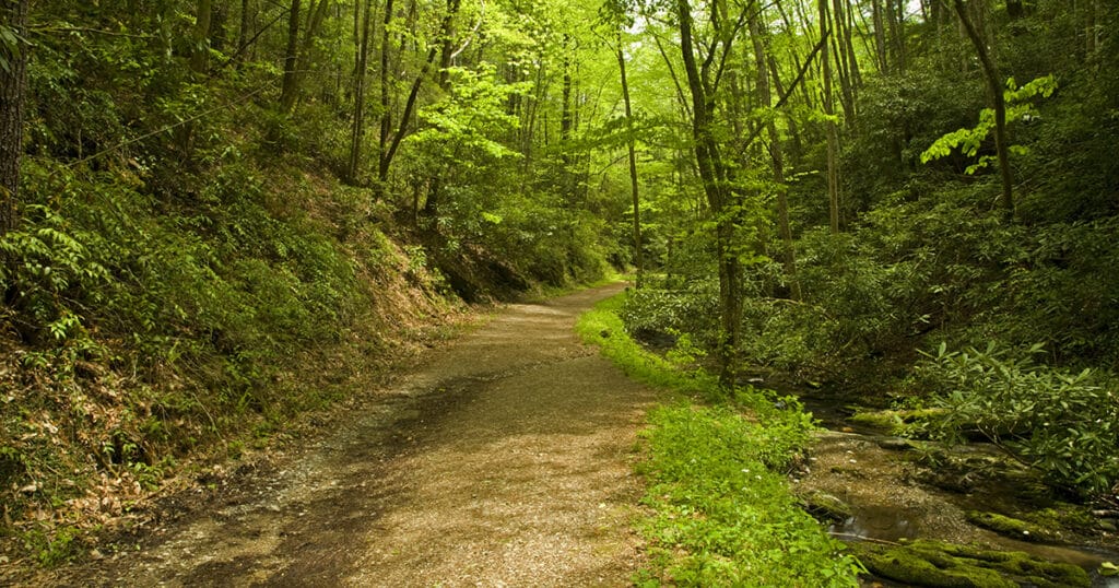
Porters Creek Trail is situated within the Greenbrier area of Great Smoky Mountains National Park. It is a 2-mile round trip to Porters Flat and a perfect trail for the whole family. This trail is one of the best places to see the wildflowers that bloom during spring.
You will start off on a gravel road that will be surrounded by an abundance of beautiful wildflowers. As you proceed, you will pass through a wooded forest full of more natural beauty and even some historical features from the pioneer days including old homesites and stonewalls. Continuing along the narrow rocky trail leads you to Fern Branch Falls, which cascades down the moss-covered rocks.
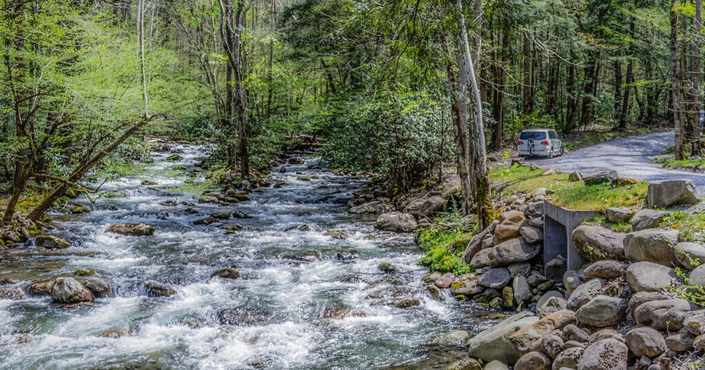
Little River Trail
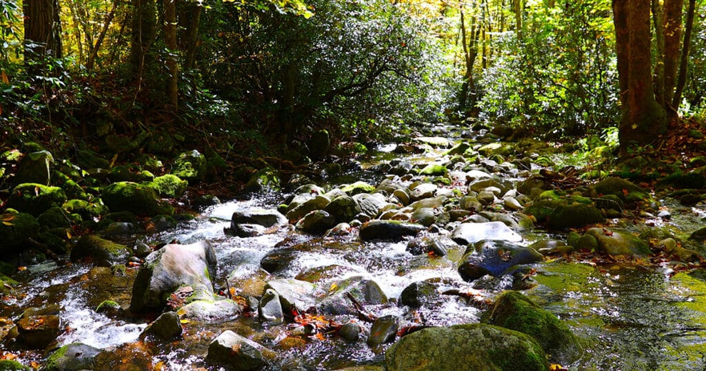
The Little River Trail is another easier level hike that is surrounded by wildflowers in the spring. Located in the Elkmont area of the park, the trail starts along the river and passes by a restored resort home originally built in the 1920’s. The trail is fairly level and flat, with peaceful streams along the way.
About 2 miles into the hike, you will see Huskey Branch Falls, a small 20 ft waterfall. A good turnaround point is shortly after at the Cumberland Gap Junction. If you wish to be adventurous, you can continue another couple of miles upstream.
Schoolhouse Gap Trail
Located between Townsend and Cades Cove is the Schoolhouse Gap Trail, an easier level trail that is about 3.8 miles long. This is another good trail for viewing wildflowers. You will get lost in the beauty that surrounds you and will want to stay all day! The trail will have you following along a small stream. Then, you will reach a point where you can turn off on a trail that will lead to the White Oaks Sinks area or just continue straight ahead towards the Schoolhouse Gap.
Kephart Prong Trail
The Kephart Prong Trail is 4 miles roundtrip and considered moderate difficulty. The Trailhead is nearly 22 miles from the Sugarlands Visitor Center along Newfound Gap Road. This area dates to the logging era and was a heavily logged area before becoming part of Great Smoky Mountains National Park.
You will see remnants of an old fish hatchery, walk over several log bridges, and even see pieces of the campsite used by the Civilian Conservation Corps back in the early 1930s. The Kephart Shelter at the junction of Sweat Heifer Creek Trail and Grassy Branch Trail marks the turnaround point of the hike.
Gear Up for Your Spring Hike in the Smoky Mountains
Before you set off on your spring hiking adventure in the Great Smoky Mountains, make sure your family is prepared. Proper hiking shoes are a must, and you may also want to carry along a backpack with a jacket, some water, and snacks depending on how long you plan to be out. If you are new to hiking, pace yourself. The change in elevation and the uneven terrain can be a challenge.
Get those hiking boots and backpacks ready and get out and enjoy the beautiful Great Smoky Mountains on one of these fun spring hiking adventures!
We love seeing Pigeon Forge through your lens. Make sure to connect with us on Facebook, Twitter & Instagram. Don’t forget to tag your photos with #mypigeonforge for the chance to be featured on our website.
You May Also Like
Best Pigeon Forge Spring Break Activities for Kids
Spring Wildflowers In The Smoky Mountains
10 Free (or Almost Free) Things to Do on Spring Break in Pigeon Forge
Recent Posts