Best Waterfall Hikes in Great Smoky Mountains National Park
On September 27, 2024
Great Smoky Mountains National Park boasts miles of hiking trails to explore. Some of the most popular trails in the park are also home to some of the most amazing waterfalls and cascades in the Smokies. If you’re looking for picture perfect spots to capture photos of the family, these stunning waterfall hikes should be at the top of your list!
Enjoy amazing views of the beautiful foliage and stunning wildflowers lining the winding paths that lead to crashing waterfalls and rushing cascades. From easy hikes for kids to more strenuous trails designed for experienced hikers, you’re sure to find the perfect waterfall hike for a unique and memorable experience that won’t soon be forgotten.
Take in one of the most picturesque waterfalls in the park at Abrams Falls
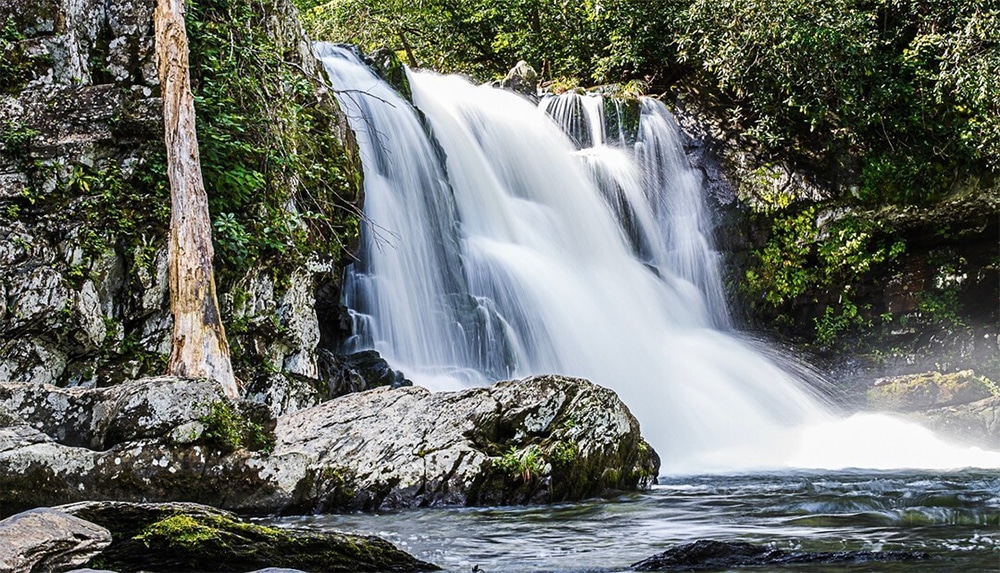
Abrams Falls is located on Abrams Creek in the Cades Cove area. This five-mile hike is a bit longer and designed for more experienced hikers, but once you reach the waterfall, you won’t be disappointed! This picturesque waterfall stands only 20 feet high, but the amount of water that rushes over the sandstone cliff is astonishing. And the pool below it is long and deep. It’s easy to see what makes this exhilarating waterfall hike one of the most popular in Great Smoky Mountains National Park.
Trail length: 5.2-miles roundtrip
Trip length: 3 to 4 hours
Trail difficulty: moderate
Getting there: access the trailhead via Cades Cove Loop Road
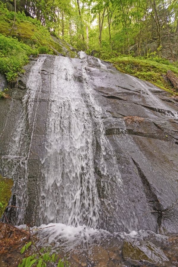
Go on an easy hike to see cascading waterfalls at Lynn Camp Prong Cascades
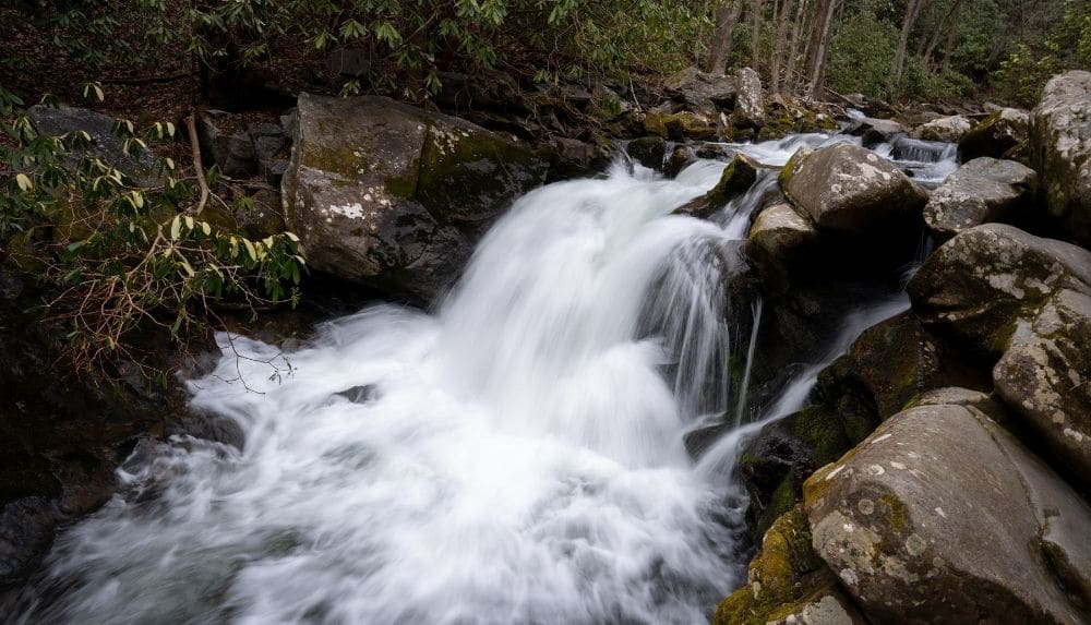
For an easy hike that is only 1.3-miles roundtrip, head to the cascading waterfalls at Lynn Camp Prong. Lynn Camp Prong is a tumbling series of cascades that flow down the mountain beside the Middle Prong Trail near the Tremont area of the national park.
The trail was once the route of an old logging railroad, making it a relatively easy path to follow. You’ll begin to see cascades just a short way into the hike. Continue upstream to view the main waterfall and another cascade. Remember to avoid climbing on rocks near the waterfall as they are often slippery.
Trail length: 1.3-mile roundtrip
Trip length: 1 hour
Trail difficulty: easy
Getting there: Middle Prong Trail on Tremont Road
Drive up to see the waterfall at The Sinks
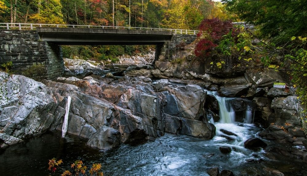
The Sinks is located on the Little River just west of Sugarlands Visitor Center. With only a short drive to reach the parking lot, you’ll find the falls just a short walk away. See the entire Little River pouring over large boulders that drop-off to create this stunning waterfall.
Getting there: take Little River Road 12 miles west of Sugarlands
Capture stunning pictures in front of the two-story waterfall at Laurel Falls
Laurel Falls is one of the other popular waterfall hikes in the Great Smoky Mountains. The trail is one of the few paved trails within the national park, making it easier to access. The waterfall stands 80-foot high and consists of an upper and lower section, divided by a footbridge that crosses the stream at the base of the upper falls. The bridge is the perfect spot to capture some great family photos in front of the waterfall!
Make sure to leave early for this waterfall hike if you’re going during the busy summer months. The trail is popular and can get congested. You also have a great opportunity to spot wildlife in this area, so keep your camera ready!
Note: Laurel Falls Trail will close for construction beginning in January of 2025, and lasting for 18 months. Please consider alternative hikes if you are visiting during this time. LEARN MORE–>
Trail length: 2.6-miles roundtrip
Trip length: 2 hours
Trail difficulty: easy
Getting there: the trailhead is 3.5 miles west from the Sugarlands Visitor Center on Little River Road on your way to Cades Cove
Cataract Falls is the perfect waterfall hike for kids
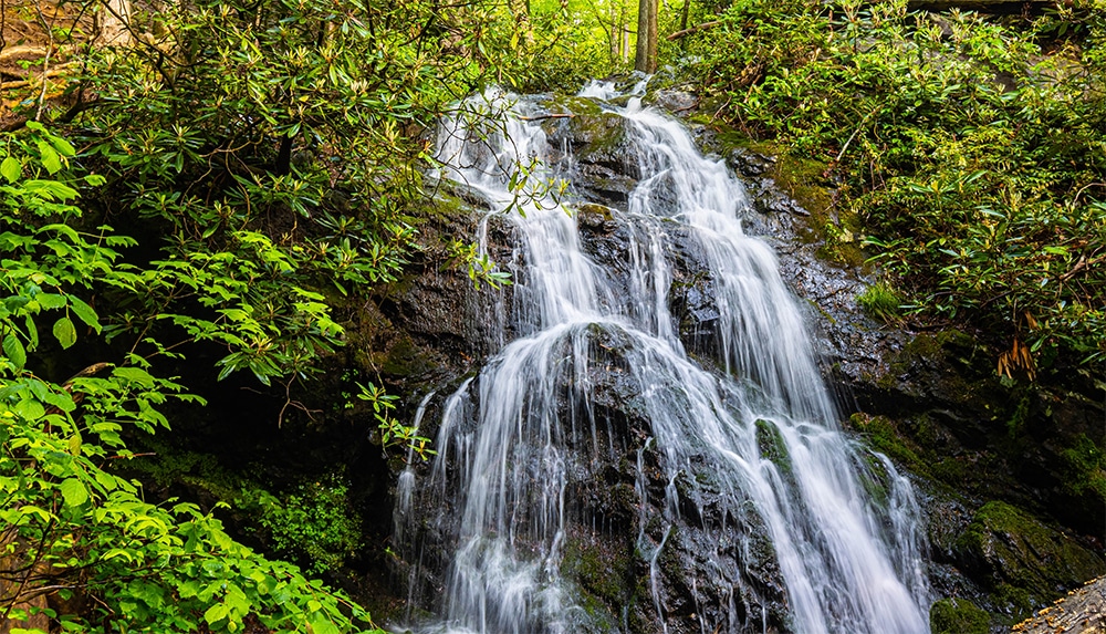
Cataract Falls is located on the Fighting Creek Nature Trail that starts behind Sugarlands Visitor Center. This quick hike is marked and easy to navigate, making it perfect for families with small children. Make your way past streams and across a foot bridge, all while taking in the plentiful wildflowers that bloom throughout the area. You may even get a chance to spot wildlife along the way! You’re sure to enjoy the views of this stunning waterfall that stands 40-feet-high.
Trail length: 1.4-miles roundtrip
Trip length: 1 hour
Trail difficulty: easy
Getting there: follow Fighting Creek Nature Trail located behind Sugarlands Visitor Center
Watch rainbows form on sunny days at Rainbow Falls
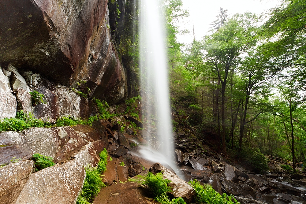
Rainbow Falls gets its name from the mist that envelops the waterfall, forming magnificent rainbows on sunny days. The 5.4-mile roundtrip hike starts from the trailhead near Roaring Fork and continues for around 4 miles beyond the falls to the summit of Mount LeConte. The rocky terrain and elevation gain make this a moderately difficult hike.
Although a slightly longer hike than other tails, the 80-foot-high waterfall is an impressive sight with its delicate sheet of water pouring off the rocky cliff. When temperatures remain cold for long periods during the winter, the ice formation that builds around the falls is another incredible sight to see.
Trail length: 5.4-miles roundtrip
Trip length: 3 to 5 hours
Trail difficulty: moderate
Getting there: take the Rainbow Falls Trail from the trailhead near the Roaring Fork Motor Nature Trail
Walk behind the cascading Grotto Falls
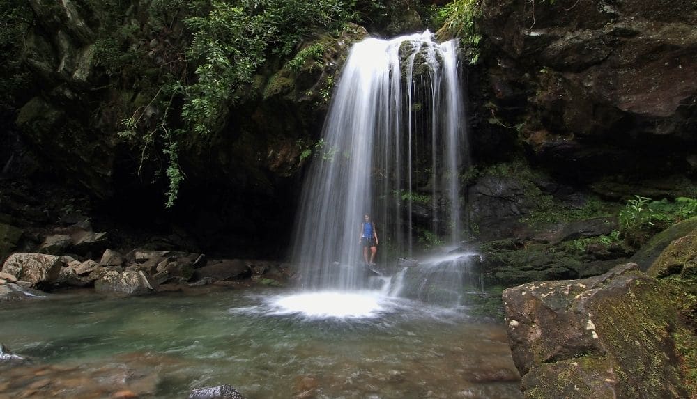
Grotto Falls is a beautiful 2.6-mile roundtrip waterfall hike that starts on the Trillium Gap Trail, located on the scenic Roaring Fork Motor Nature Trail. This trail is considered to be of moderate difficulty with a well-worn path that is easy to follow. Just be careful once you reach the falls as the rocks are slippery. If you’re visiting during the spring months, the trail is a great place to see the beautiful spring wildflowers.
The unique and amazing feature of this 25-foot waterfall is that you can walk behind it! It’s one of the best spots for some amazing photo opportunities, so get your camera ready. Continue along the Trillium Gap Trail afterwards to visit the summit of Mount LeConte.
Trail length: 2.6-miles roundtrip
Trip length: 2 to 3 hours
Trail difficulty: moderate
Getting there: follow the Trillium Gap Trail on the Roaring Fork Motor Nature Trail
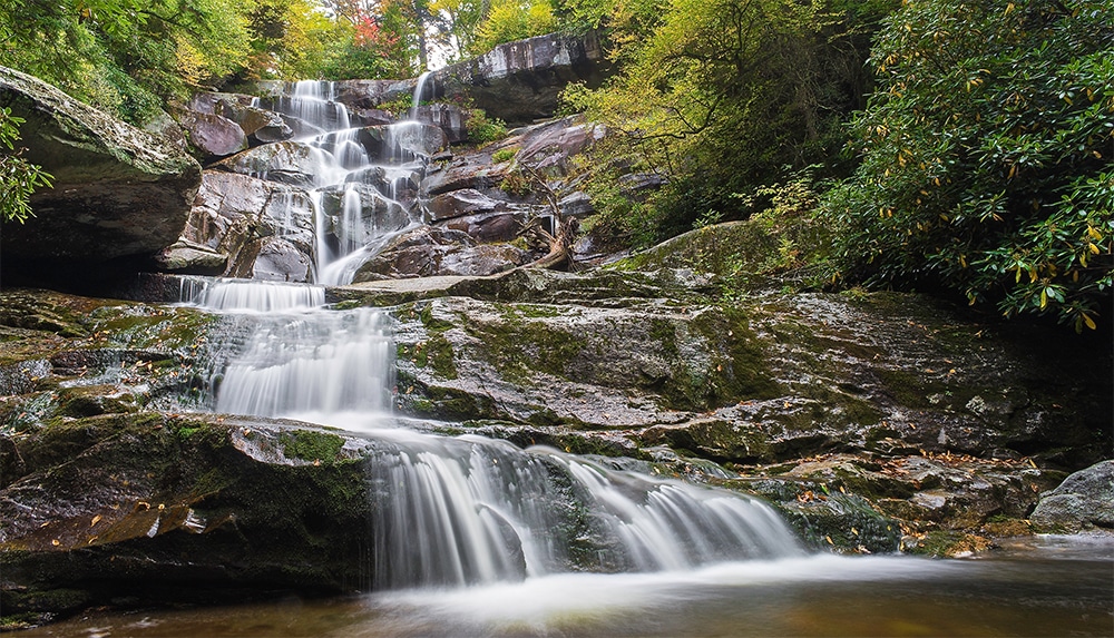
See spectacular wildflowers at Fern Branch Falls
Fern Branch Falls, located along Porters Creek Trail, stands at nearly 50-feet high. The Porters Creek area is known for its magnificent spring and summer wildflowers, as well as its historic sites. The trail follows along the banks of Porters Creek, taking you past historic farm sites, a cabin and a cemetery. Continue through larger old-growth trees and take in the magnificent display of blooming wildflowers.
Fern Branch Falls got its name from all the ferns and mosses that surround it and the field of boulders that lie directly below. The falls drop off the ridge near the trail end and can be exceptionally magnificent during high water flows. This is another fun hike the whole family can enjoy any time of year!
Trail length: 3.7-miles roundtrip
Trip length: 3 to 4 hours
Trail difficulty: easy
Getting there: begins from the Porters Creek Trailhead in Greenbrier
Hike to Ramsey Cascades, the Smokies’ tallest waterfall
Ramsey Cascades is the tallest waterfall in Great Smoky Mountains National Park. With a 2,000-foot gain in elevation to the falls and a total of 8-miles roundtrip, this waterfall hike is one of the more strenuous to complete. The Ramsey Cascades Trail is located near Greenbrier and follows rushing rivers and streams most of the way. The last couple of miles take you through old-growth hardwood forest filled with towering trees.
The spectacular waterfall drops 100-feet over rock outcroppings and collects in a pool below. If you look closely, you may be able to spot the numerous salamanders camouflaged against the rocky backdrop.
Trail length: 8-miles roundtrip
Trip length: 5 to 7 hours
Trail difficulty: strenuous
Getting there: follow the Ramsey Cascades Trail near Greenbrier
Discover some of the best waterfall hikes in the Great Smoky Mountains on your next visit to Pigeon Forge. You’ll find countless opportunities to capture stunning photos and create lasting memories of your family with these picturesque waterfalls as the backdrop. Whether you prefer an all-day hiking adventure or quick and easy hike for the kids, you’re sure to find the perfect trail for every skill level. Start planning your next Smoky Mountain adventure today!
You May Also Like:
4 Smoky Mountain Hiking Trails Perfect for Kids
Best Spots for Capturing Fall Foliage in the Smoky Mountains
Best Scenic Drives in the Smoky Mountains to View Fall Colors
Recent Posts


Categories
Subscribe to Newsletter
Sign up for the quarterly Group Tours e-Newsletter to get access to specials, event updates and more!
Travel Planning Guide
Use our 2025 Travel Guide to help build your family trip, romantic getaway, or a fun friends' weekend.
Order Guide